>> Solar, Weather and Climate Data >> Exemplary Australian Solar Energy Atlas (Exemplary ASEA)
Exemplary Australian Solar Energy Atlas (Exemplary ASEA)
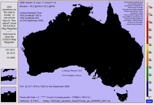
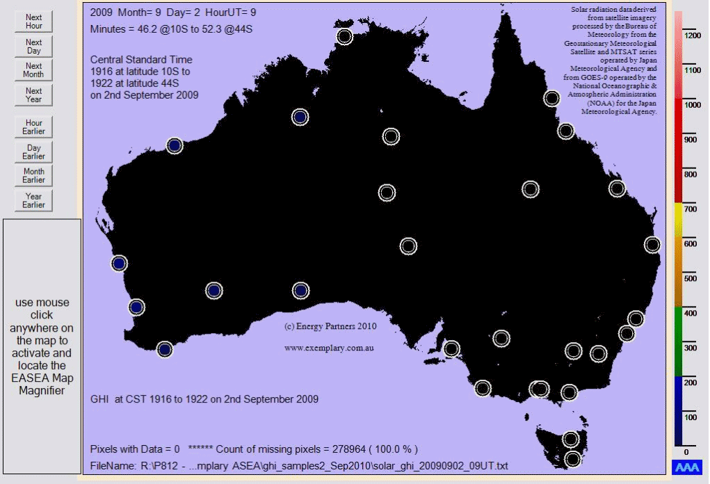
The moving image shown above represents the hourly transition of global horizontal irradiance (GHI) values
between dawn and dusk on a day in early spring 2009, as displayed by the Exemplary Australian Solar Energy Atlas (Exemplary ASEA).
The colour-coded map of Australia is created using GHI measurements on a grid with pixels approximately 5km x 5km.
The colours of each pixel represent the 'GHI measured from satellite data' and these colours are as per the legend on the right.
Kangaroo Island is highlighted in the two square insets displaying 4x and 9x magnification as shown in the bottom left hand corner.
The second animated image below has the addition of 28 black outlined opaque circles that represent the 28 sites (capital cities,
major towns and particular locations of meteorological interest) of the
Australian Solar Radiation Data Handbook (ASRDH).
The colours inside each circle represent the 'GHI monthly average' and also correlate directly to the colour banded legend on the right.
Visual juxtapositions between the opaque circles and surrounding pixel values allow for a comparison between real time data and long-term data.

The Exemplary ASEA is also able to display Direct Normal Irradiance (DNI) data as estimated from GHI data.
GHI data is derived from photographs taken from outer space, by the
Bureau of Meteorology processing imagery from satellites operated by Japan Meteorological Agency
and National Oceanographic & Atmospheric Administration (NOAA) for the Japan Meteorological Agency.
Exemplary Energy is developing the Exemplary Australian Solar Energy Atlas (Exemplary ASEA):
-
Climatic averages and other statistics for defined areas including the whole of Australia
-
Global irradiation or direct beam values on a horizontal or sun-tracking plane
Exemplary Energy produces targeted data sets extracted from the Exemplary ASEA database:
-
Engineering averages and other statistics as for the ASRDH and AUSOLRAD
-
Hourly time series for any location (as geographically focused as 5 x 5 km, 0.05 * 0.05 degrees Latitude and Longitude)
- Real time services for individual locations